The Proxy
Landscape
Water is a shapeless medium that becomes legible through the landscapes, infrastructures, and bodies that direct it.
- Type
- Collaborative research and design project
- Site
- Jamaica Bay, New York
- Focus
- Watersheds · salt-marsh repair · low-tech machines
Can water reveal—and help repair—the hybrid urban landscape?
Jamaica Bay is a coastal environment shaped by both tidal ecologies and metropolitan infrastructure. The project treats water as a proxy: as it moves through pipes, streets, soil, wetlands, and bodies, it makes each of these conditions visible. Rather than proposing a single protective object, The Proxy Landscape develops a distributed set of low-tech machines that identify where water systems meet, then work with those intersections to reduce pollution, erosion, and salt-marsh loss.
Salt marshes are an urban ecological boundary.
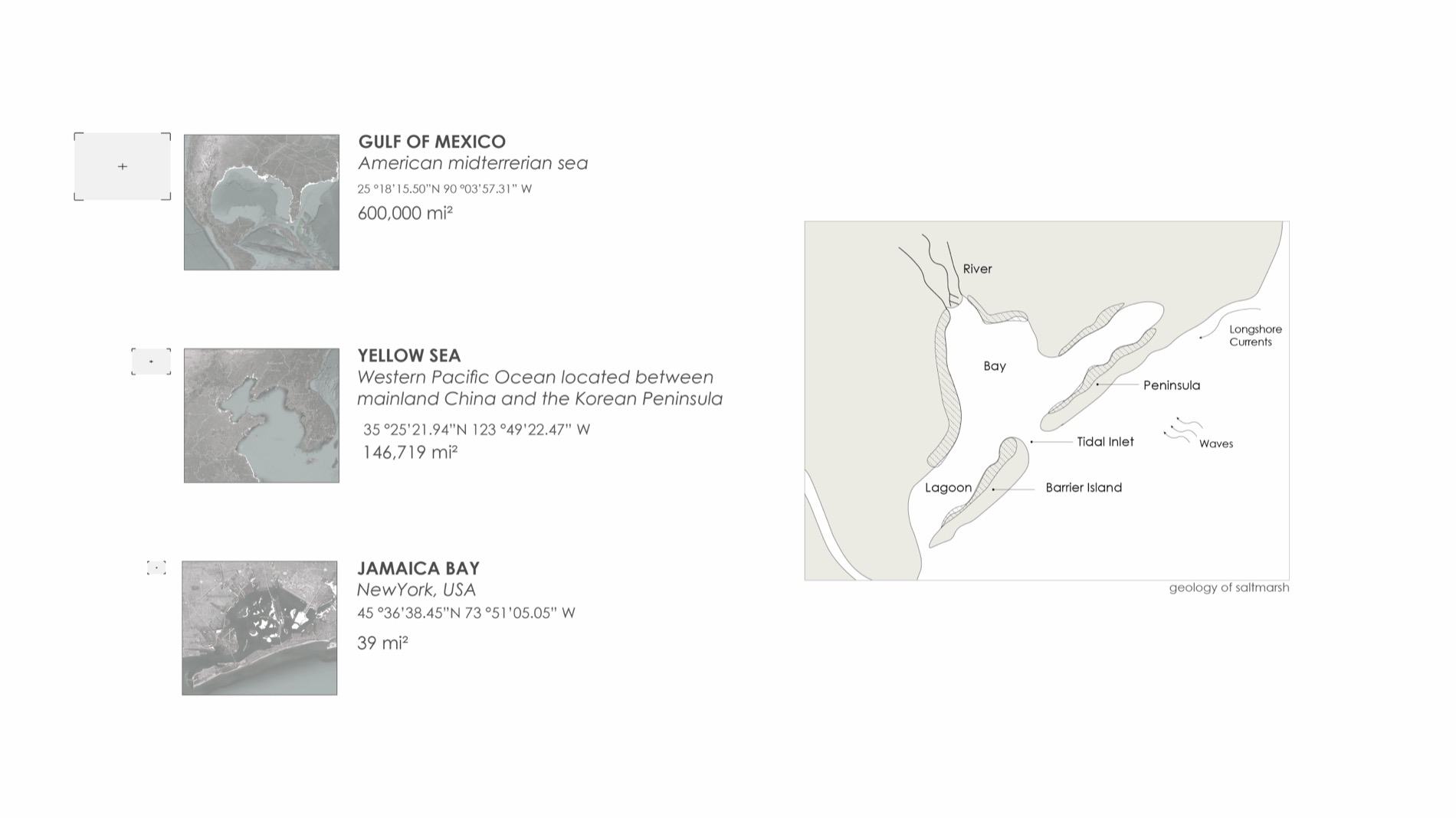
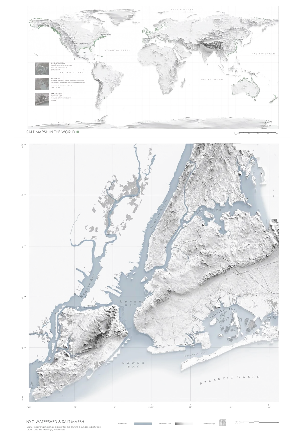
Salt marshes form where land, barrier islands, tides, and sediment create protected coastal basins. They also coexist with highly urbanized territories. The research begins by locating Jamaica Bay within this broader condition: a productive estuary whose wetlands are continually altered by development, dredging, sea-level rise, and contaminated runoff.
Water moves with, and against, human intention.
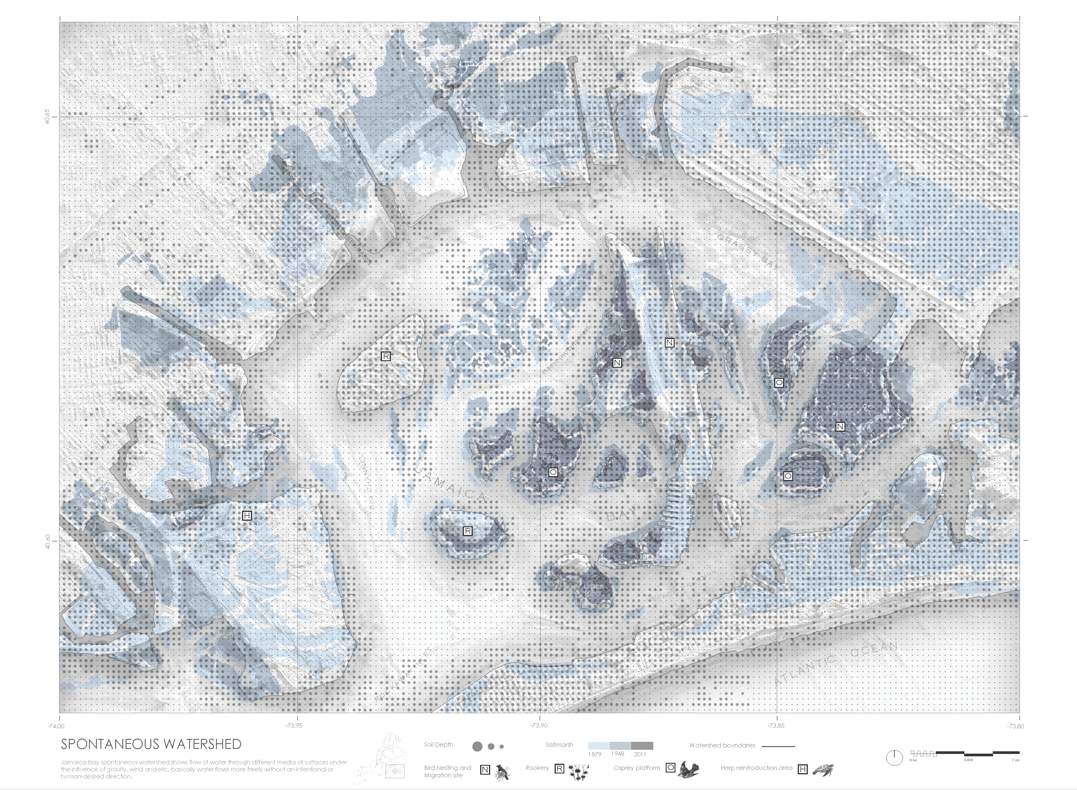
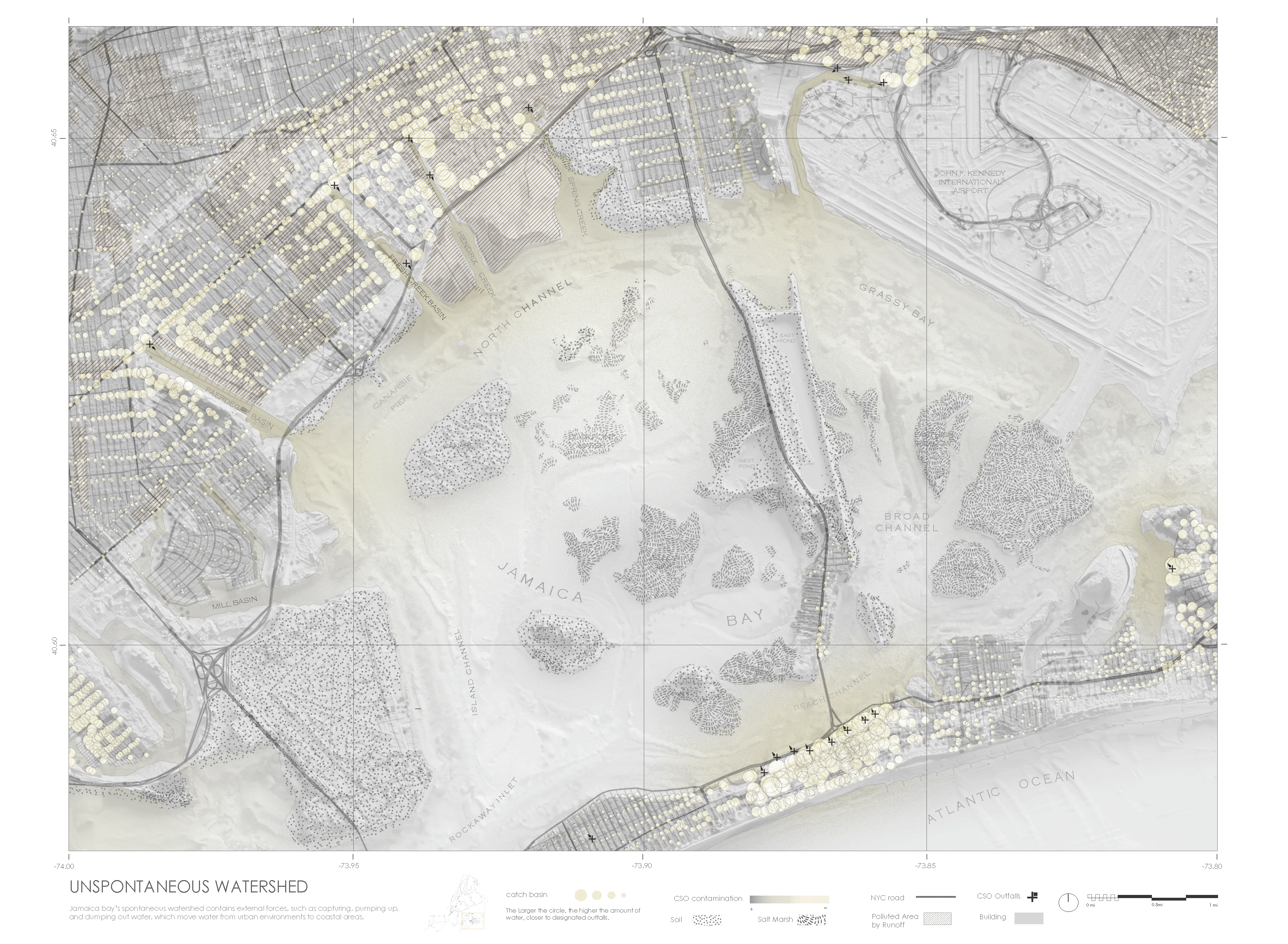
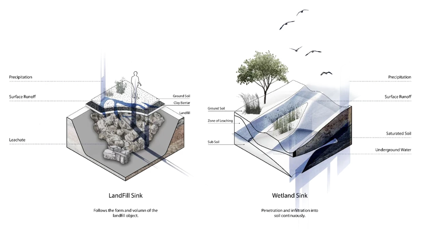
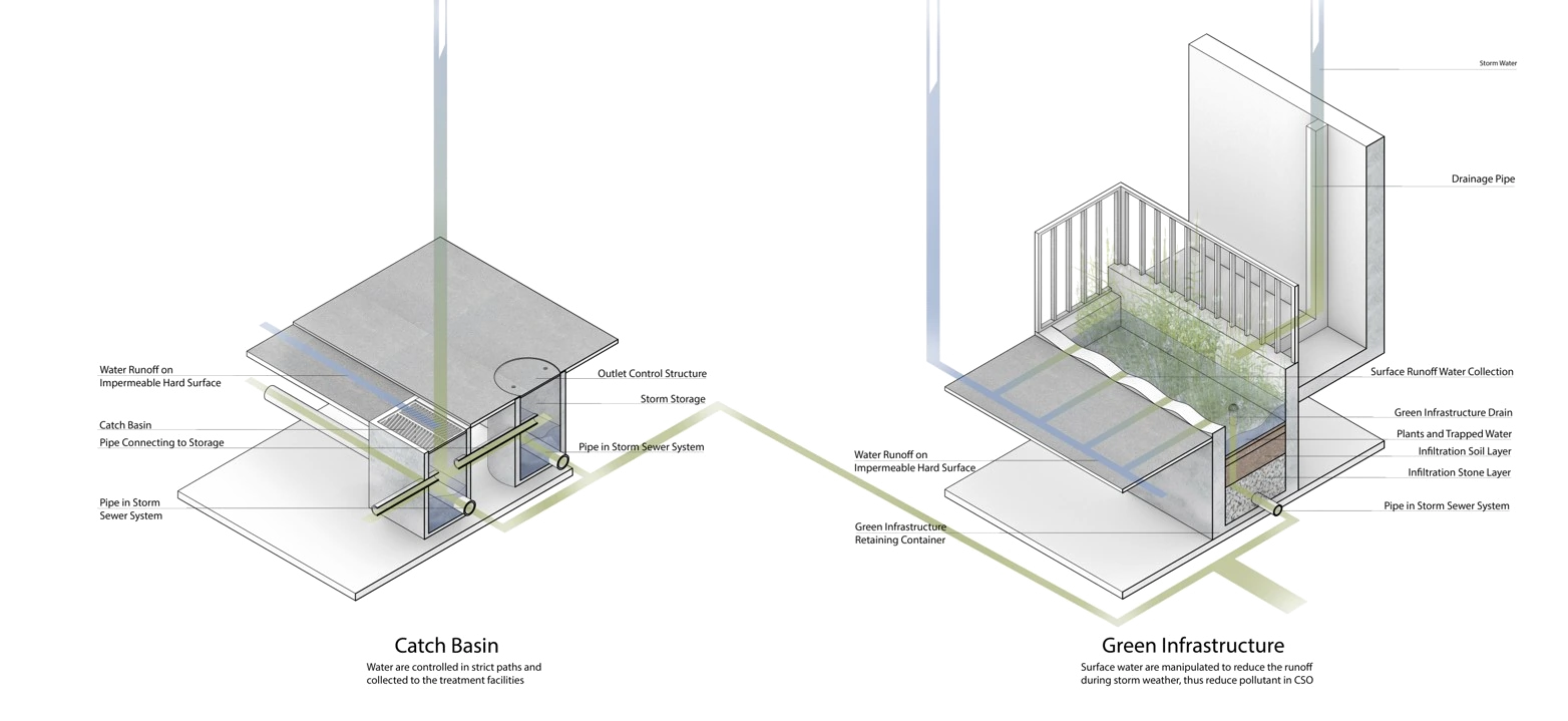
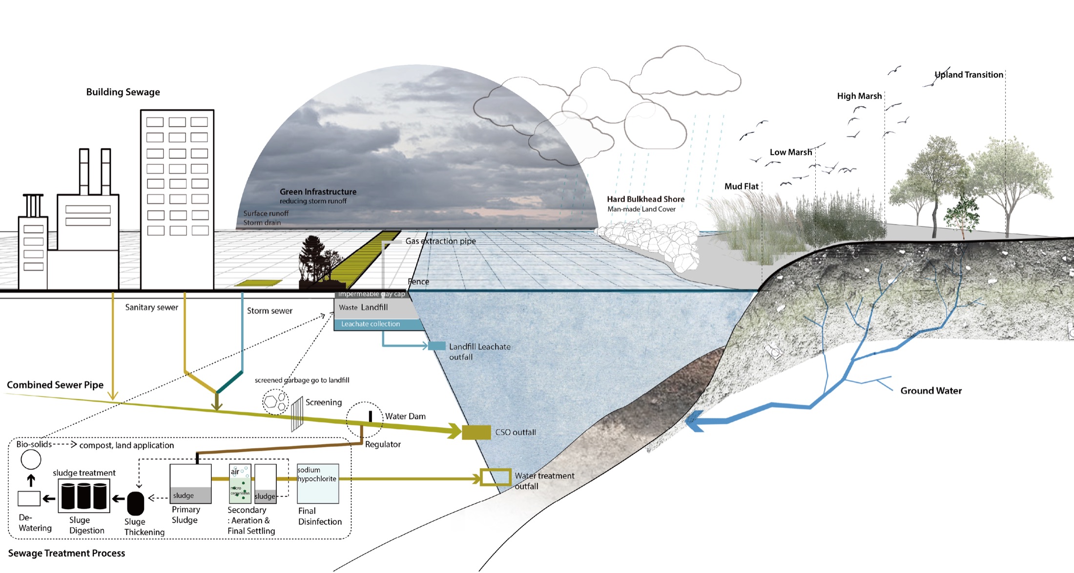
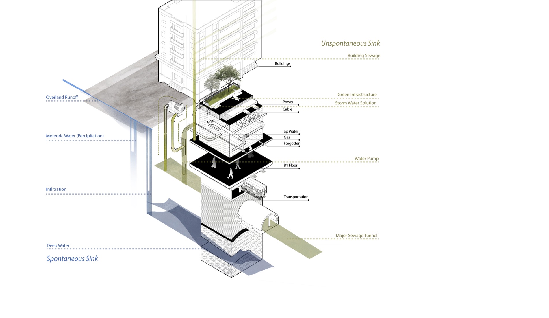
The project distinguishes spontaneous water from unspontaneous water. Spontaneous water follows gravity, wind, topography, and ground conditions. Unspontaneous water is captured, accelerated, held back, pumped, and discharged by human infrastructure. Their intersection is not a clean boundary: it is where combined sewer outfalls, landfills, runoff, marsh soils, and tidal flows produce the most contested landscapes.
Maps turn flow into evidence.
Mapping connects regional marsh degradation to specific conditions in Jamaica Bay. The regional drawing traces historical loss, topography, and water movement; the site-scale drawing identifies catch basins, contaminated land, CSO outfalls, shoreline conditions, and animal habitat. Together, they locate the sites where intervention can be both ecological and publicly legible.
Each intersection produces a different problem.
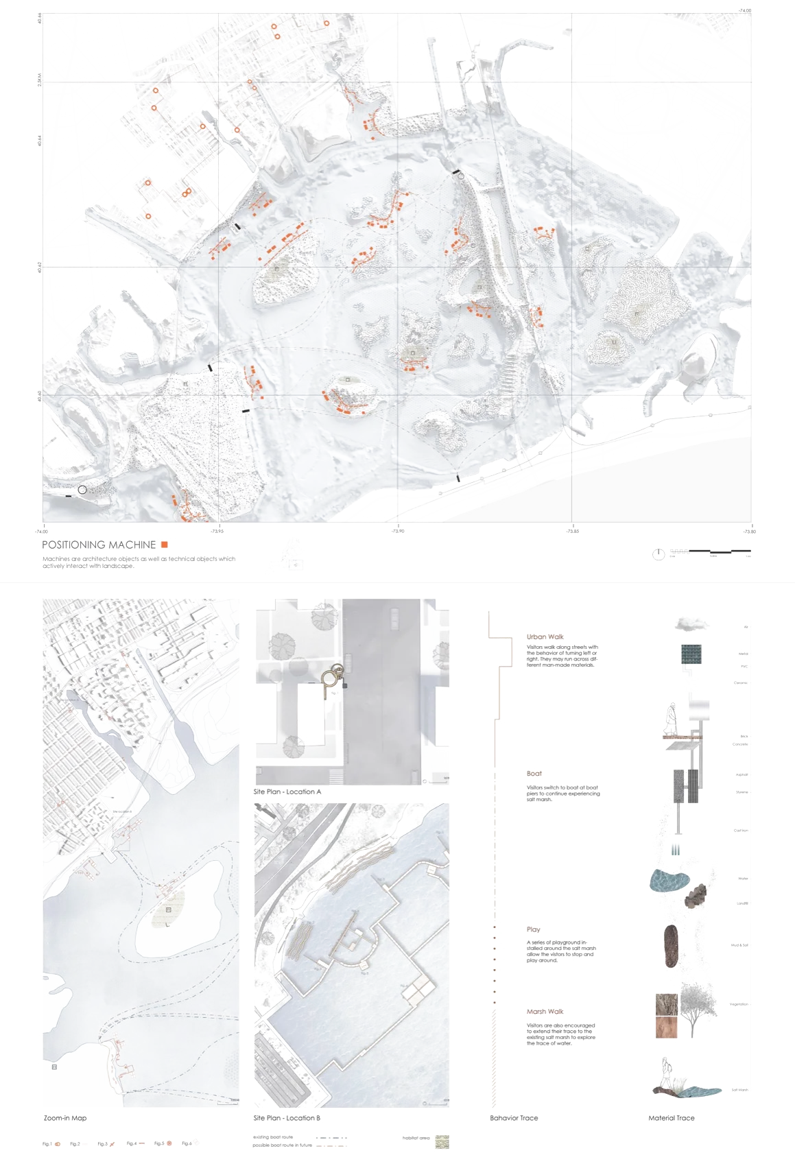
Three locations translate the mapping into localized evidence. At Spring Creek, CSO discharge mixes infrastructure-driven water with marsh processes. At Broad Channel, dredging and tidal energy intensify erosion. At West Pond, living-shoreline strategies reveal the fragile relation between sediment, water, vegetation, and public access.
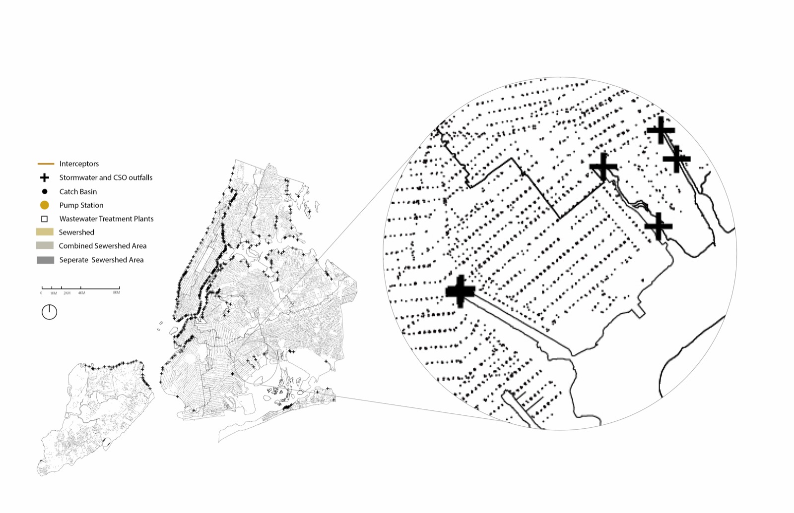
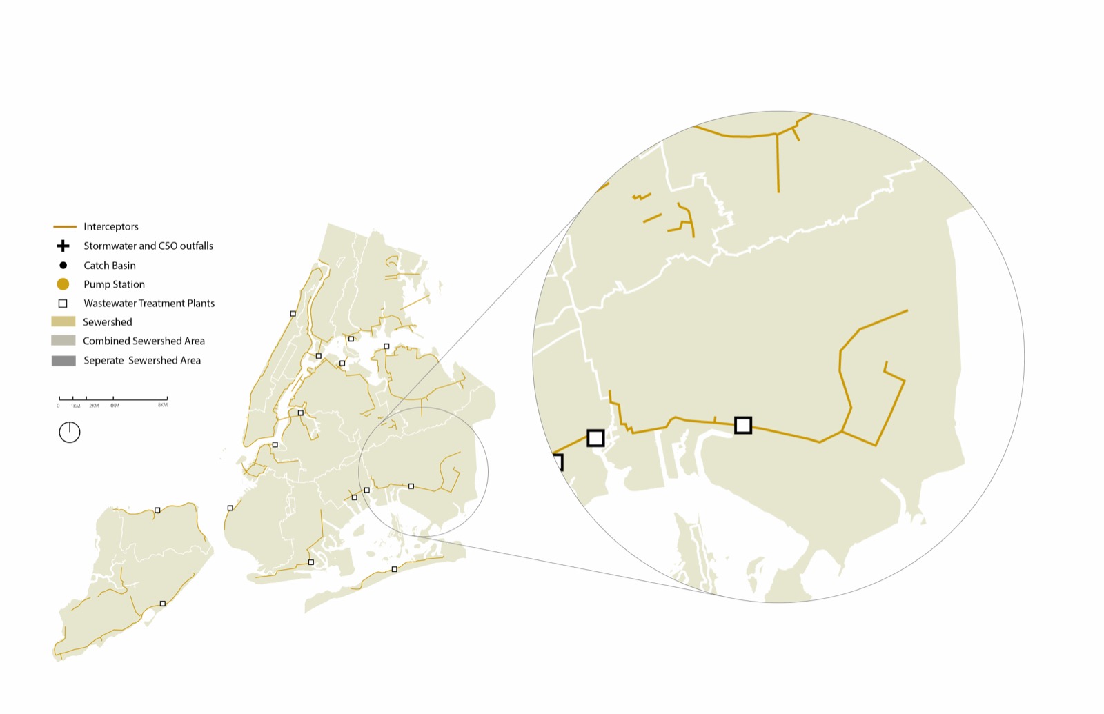
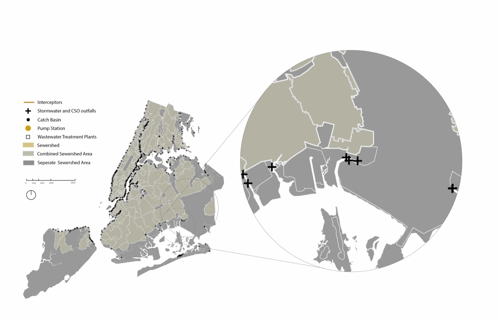
Six forms of restorative landscape labour.
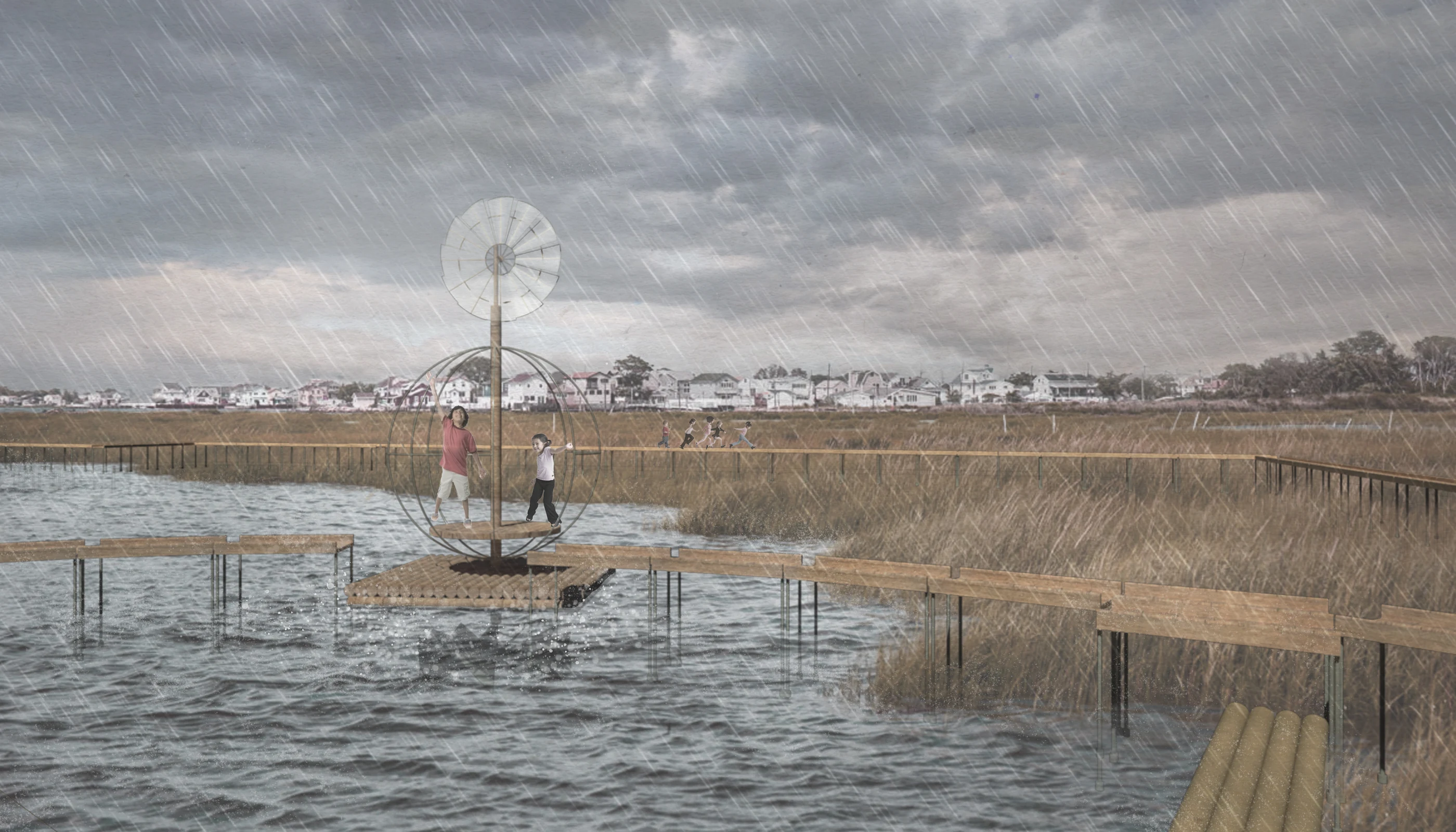
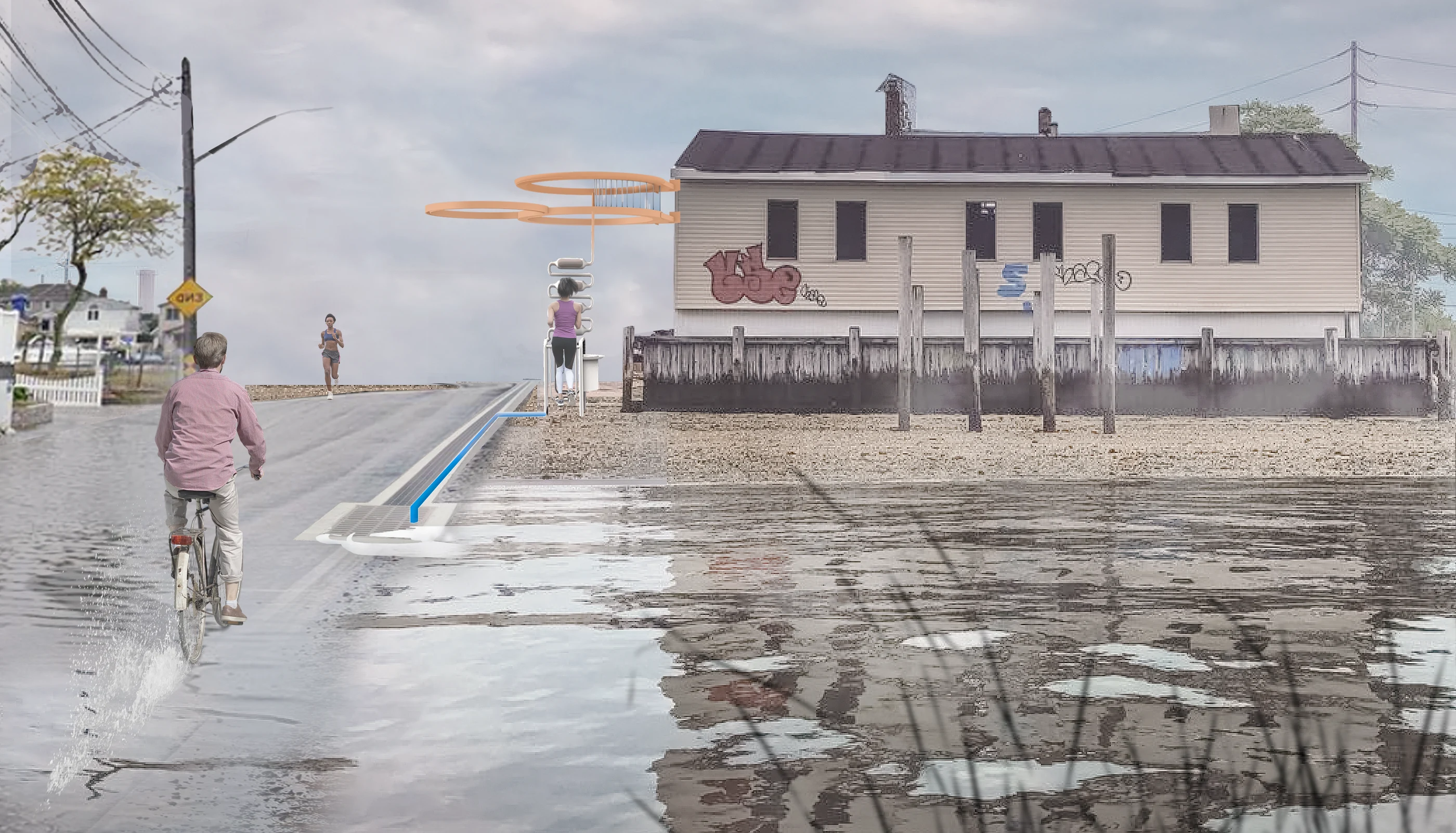
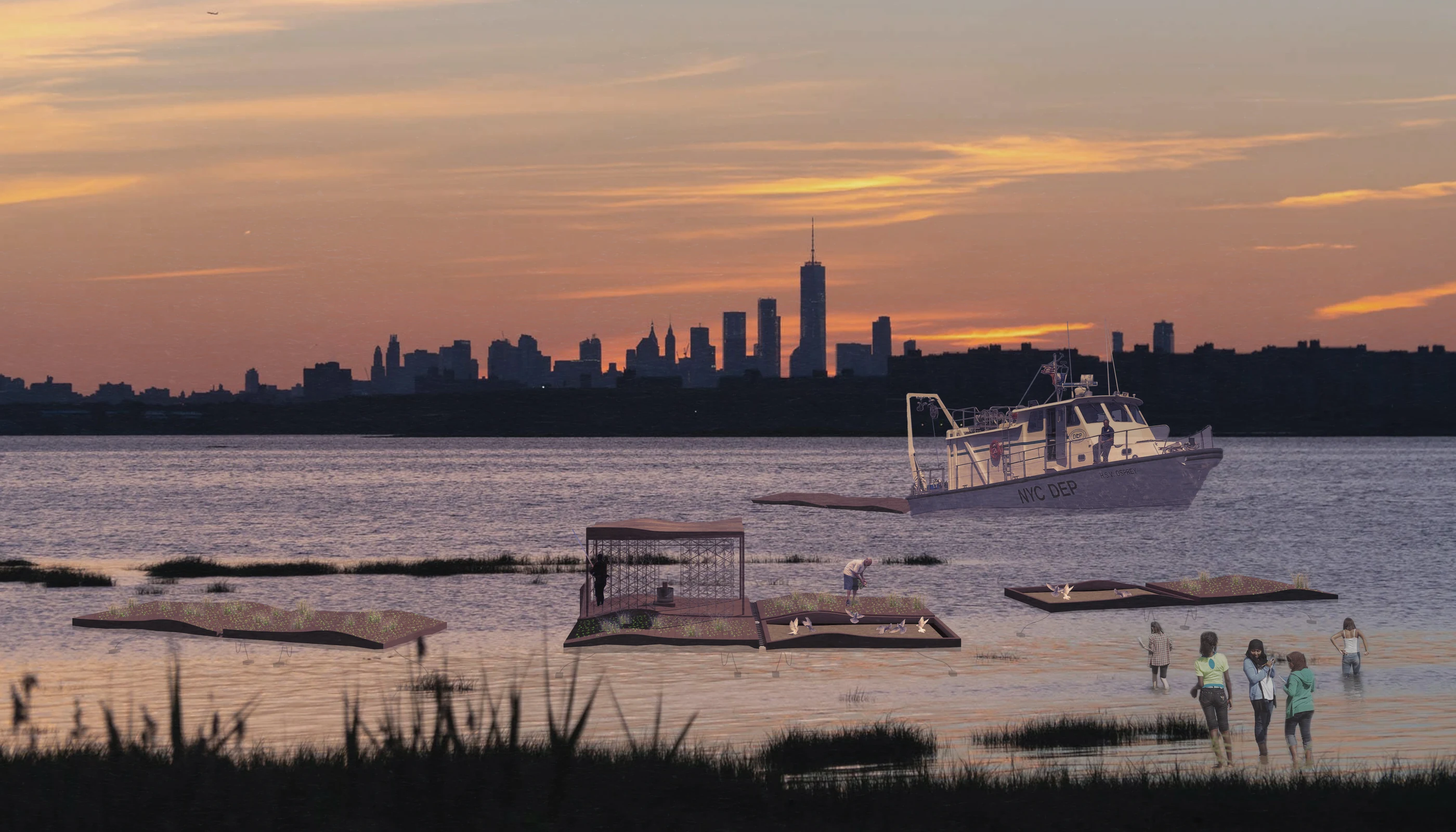
The machines are deliberately small, low-tech, and theatrical. They filter, catch, lift, mix, and attenuate water through human, wind, wave, and tidal power. Each is both an architectural object and a technical instrument; together they form a chain reaction across the bay rather than a centralized engineering solution.
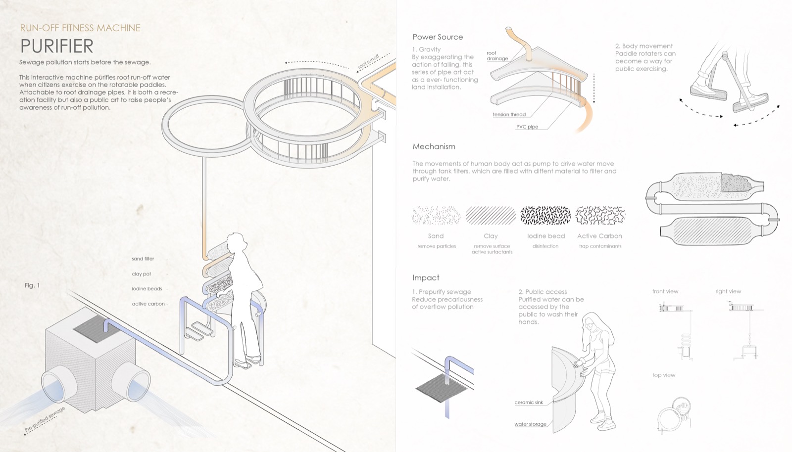
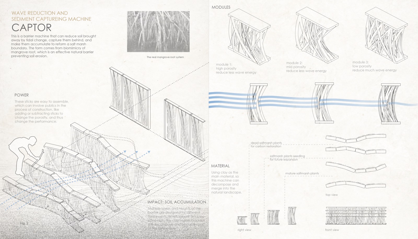
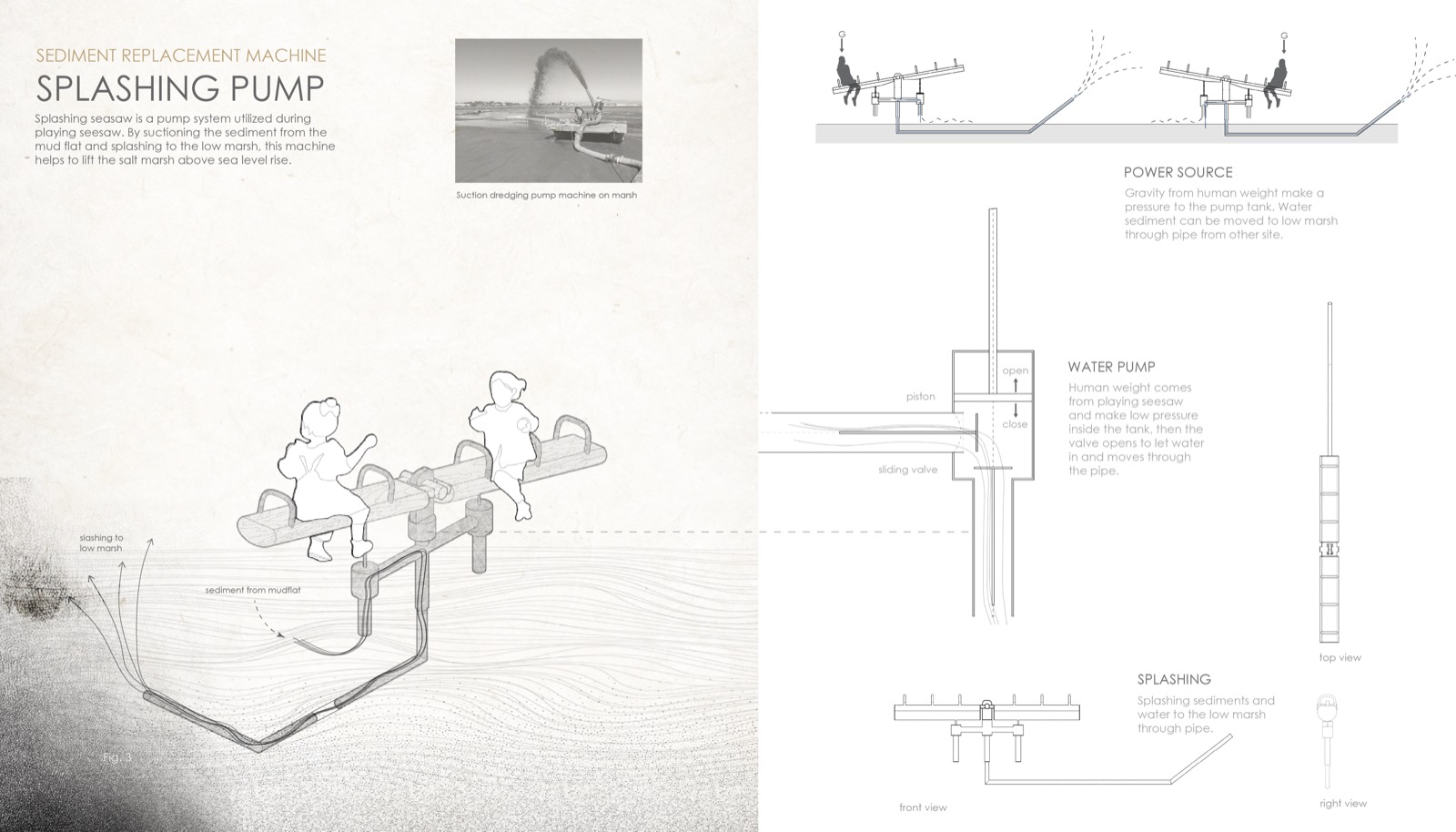
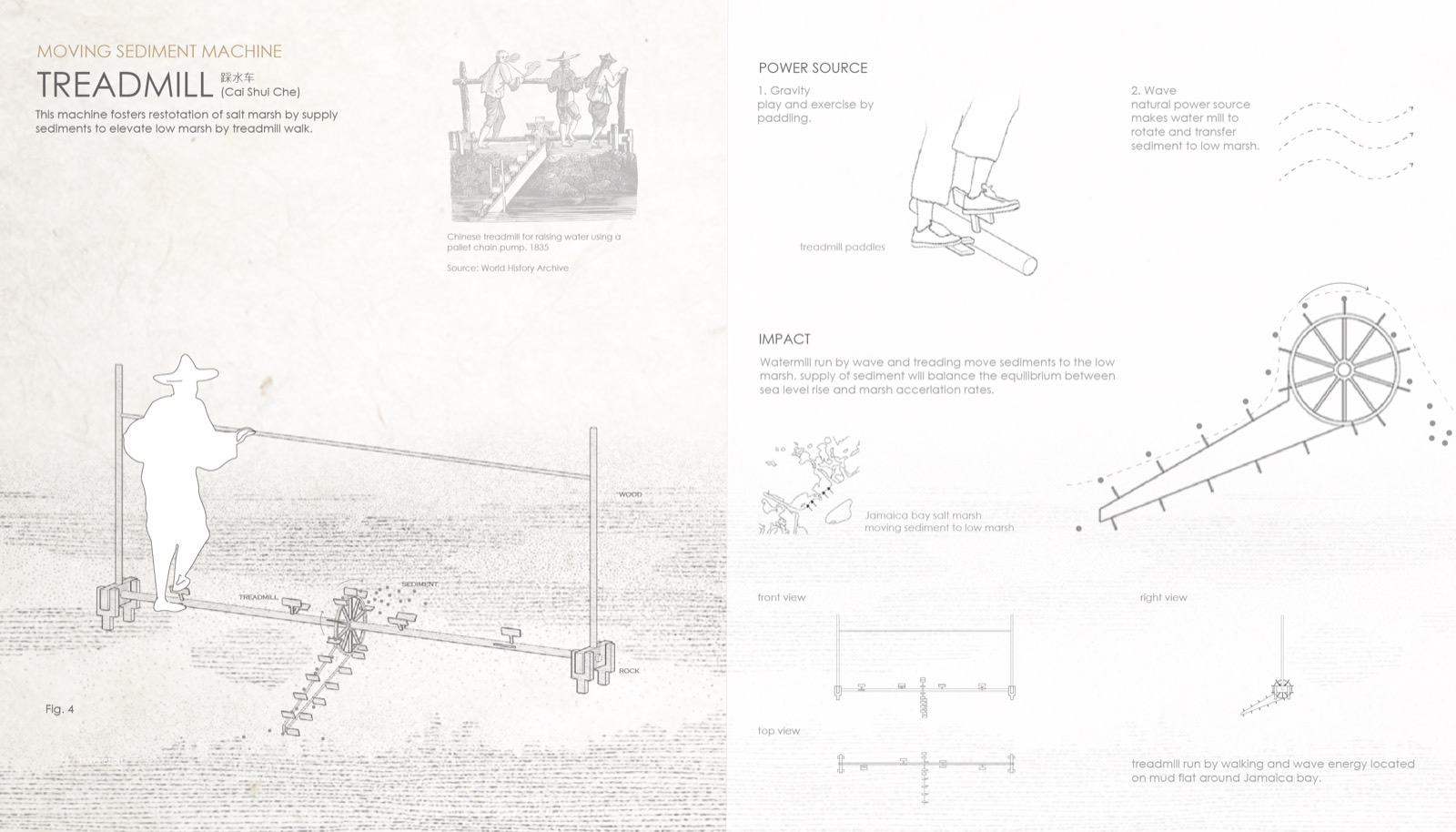
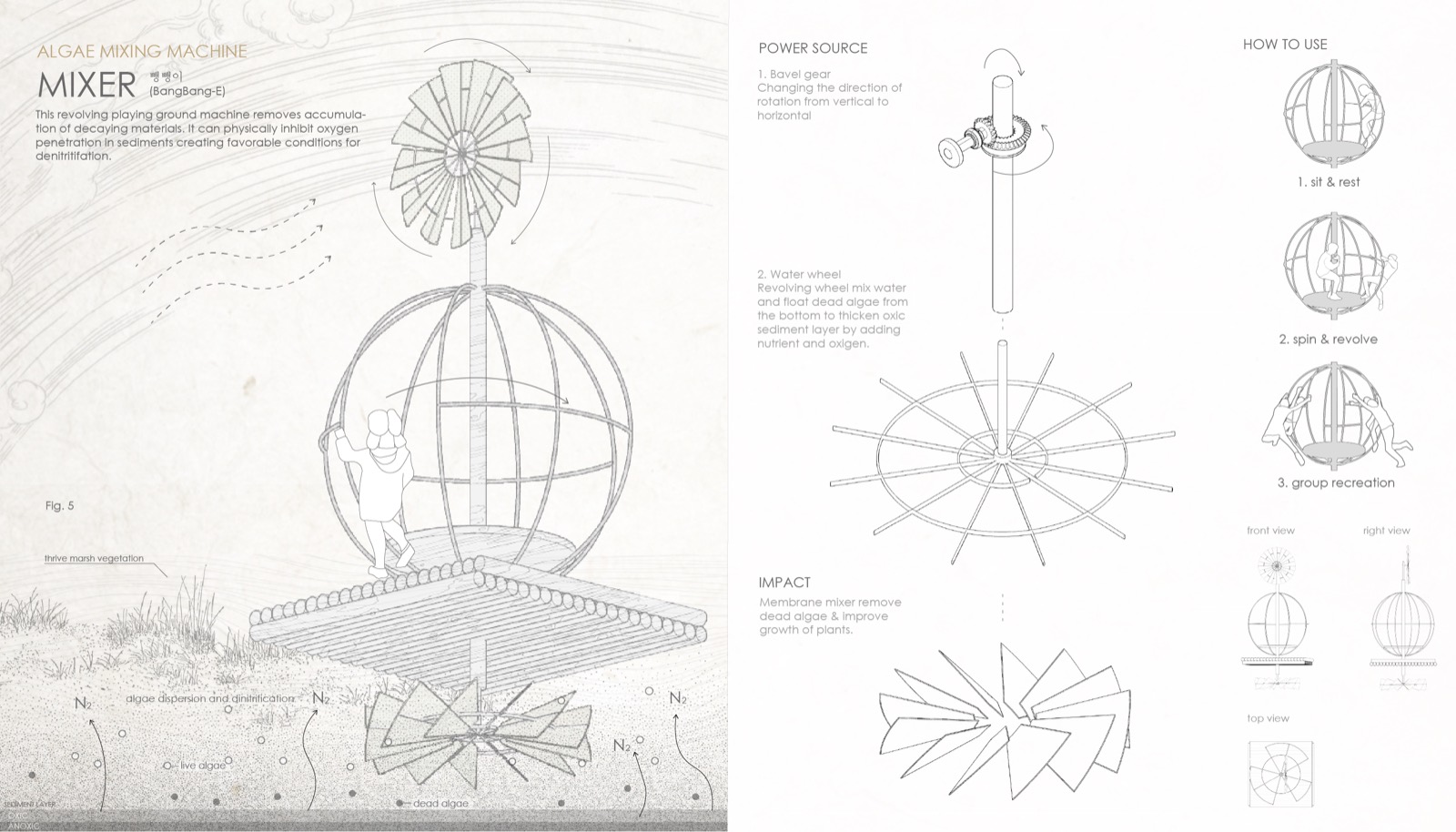
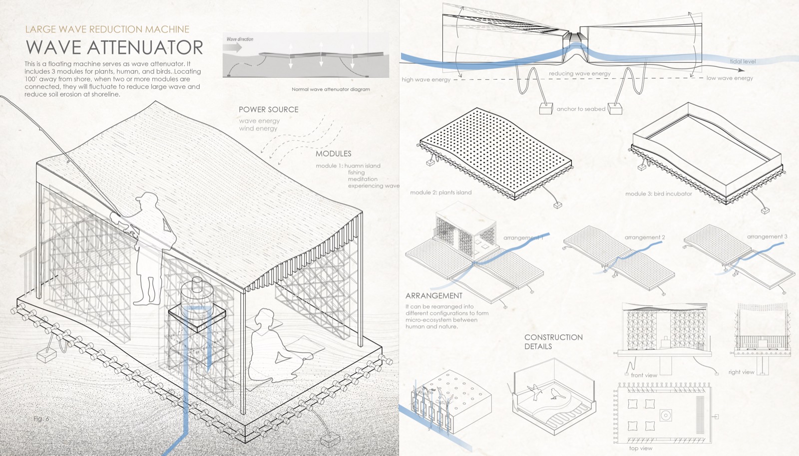
Machines make a route through changing water conditions.
At the larger scale, the six machines are positioned along a journey from urban material to water, marsh, soil, and shared habitat. Their value is cumulative: runoff is filtered upstream; sediment is moved and retained; wave energy is reduced; and the edge becomes a place where people can observe, participate in, and care for ecological change.
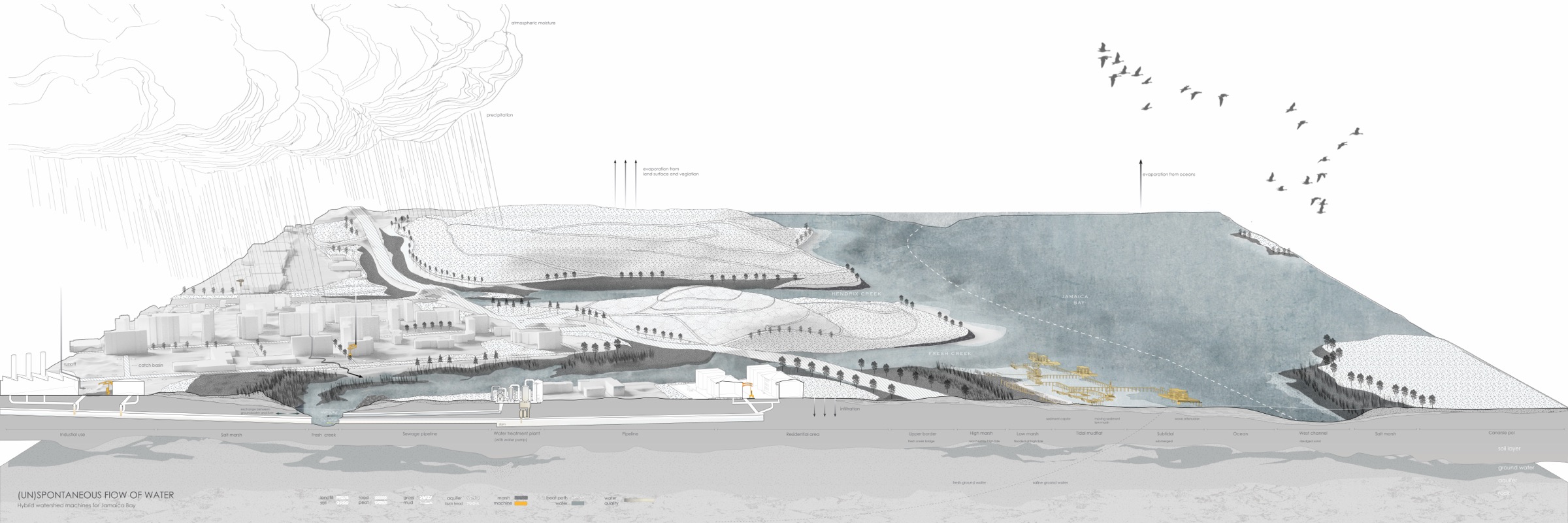
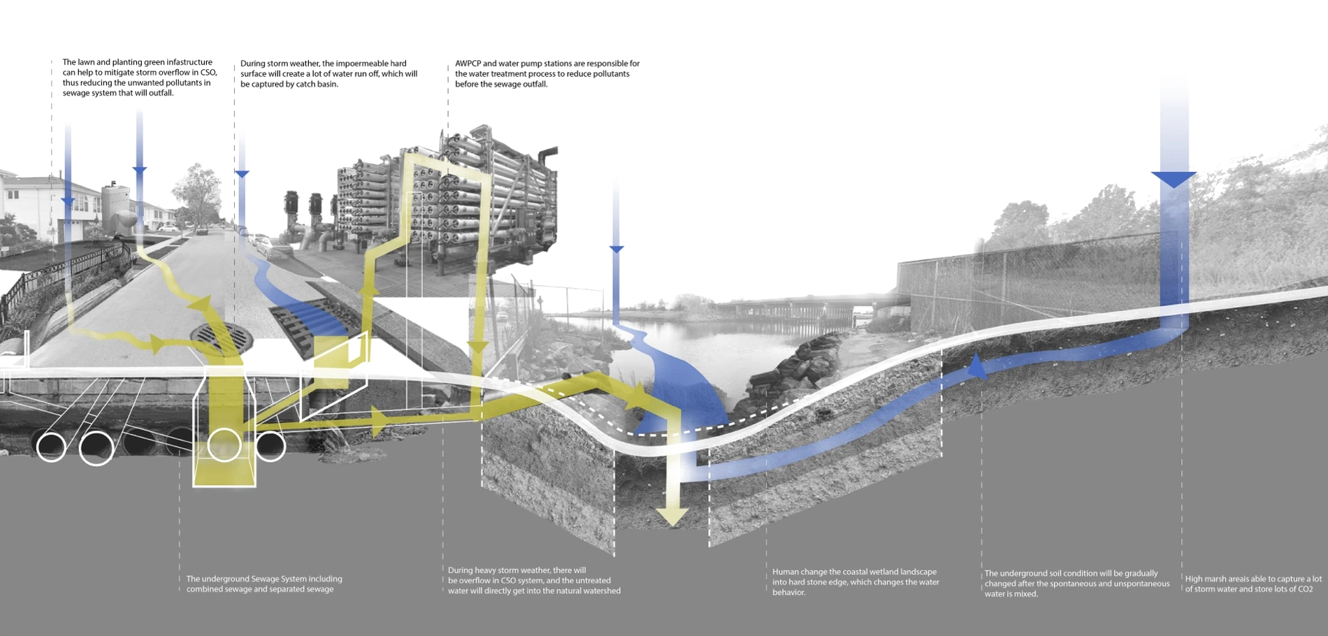
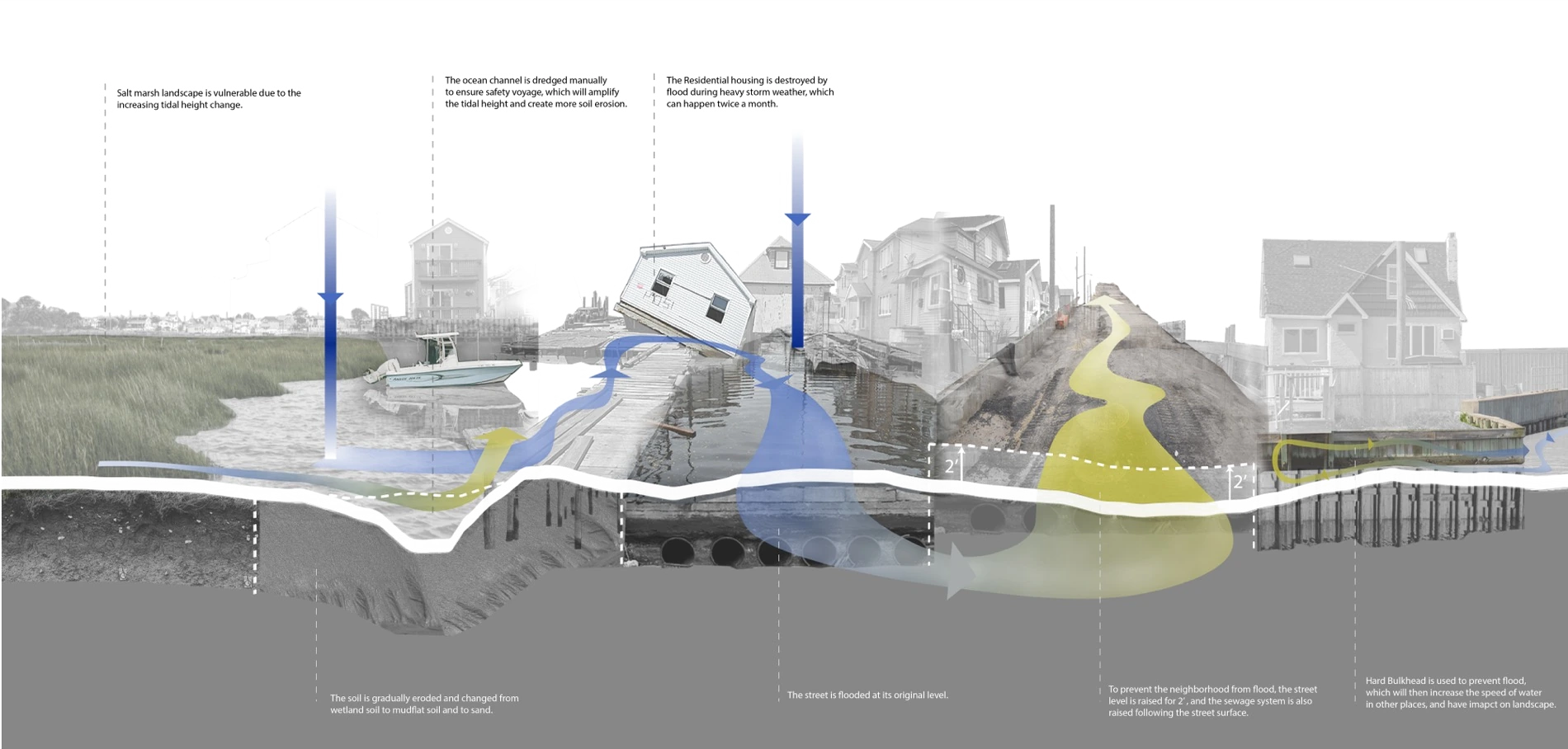
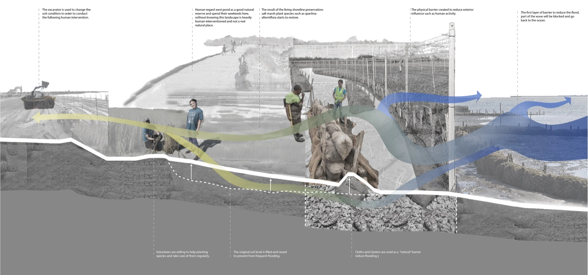
Restoration as participation, not extraction.
These machines do not claim to replace large-scale coastal engineering. They make environmental processes accessible at a human scale and transform maintenance into a shared public experience.
The proposal is speculative, but its central question remains practical: how might small, distributed interventions reveal the costs of urban water systems while helping coastal landscapes adapt?